Drone Topography
SKYCAM TUNISIE is one of the first companies to offer innovative solutions for topography and 3D modeling by drone at a lower cost.
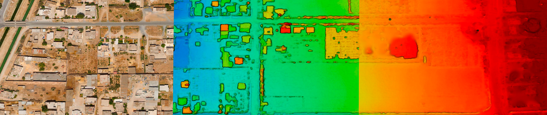
3D aerial modeling service
We realize building capture by drone to allow us to determine the volumes and dimensions of a structure. The capture is then analyzed and processed and reconstructed in 3D, mesh and texturization and 3D digital model. 3D modeling allows applications as diverse as the creation of plans, assistance with renovation projects, the integration of elements into a film or animation, the creation of objects with a 3D printer, the integration of future work in a project, etc.

Post Treatment
- Dataset quality control
- Shooting System Calibration
- Correlation of pairs of images Aerial triangulation
- Implementation of checkpoints
- Control and manual retouching of cutting lines
- Radiometric and geographical quality control
- Cropping
- Editions of a processing report
- Delivery various formats
Quote request