Drone Topography
SKYCAM TUNISIE is one of the first companies to offer innovative solutions for topography and 3D modeling by drone at a lower cost.
Topographic survey service
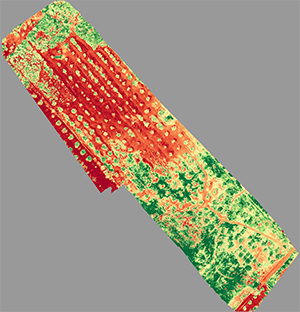

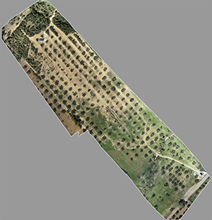

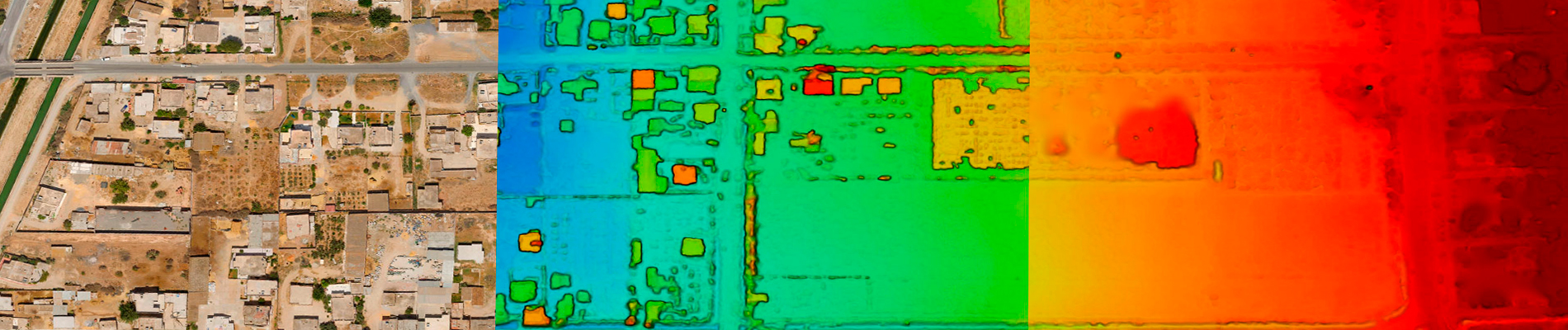
By carrying out low-altitude recordings, we will be able to detect terrain anomalies with centimeter resolution in order to help expert surveyors and professionals in their decision-making and provide the data necessary for projects that cover large areas. surface, for example, measures and calculates volumes or areas, visualizes large surfaces, makes metric readings, monitors the progress of construction sites, identifies wetlands, land differences, the impact of a work of art on a site and many other possibilities.
The use of the SKYCAM TUNISIE drone allows us to produce a large volume of geo-referenced 3D data in a short time with complex shooting possibilities as well as carrying out operations on dangerous or inaccessible sites on foot.
SKYCAM TUNISIE captures all types of terrain and surfaces whether in the field of topography, 2D or 3D mapping, models 3D, land use planning, landscaping, building, public works, site monitoring, agriculture, archaeology, GIS (Geographic Information System), architecture, geology but also landscape studies or natural environment and this with great precision.
3D aerial modeling service
We realize building capture by drone to allow us to determine the volumes and dimensions of a structure. The capture is then analyzed and processed and reconstructed in 3D, mesh and texturization and 3D digital model. 3D modeling allows applications as diverse as the creation of plans, assistance with renovation projects, the integration of elements into a film or animation, the creation of objects with a 3D printer, the integration of future work in a project, etc.
Post Treatment
- 1.Dataset quality control
- 2.Shooting System Calibration
- 3.Correlation of pairs of images Aerial triangulation
- 4.Implementation of checkpoints
- 5.Control and manual retouching of cutting lines
- 6.Radiometric and geographical quality control
- 7.Cropping
- 8.Editions of a processing report
- 9.Delivery various formats
